It’s no secret that Thailand hosts some breathtaking natural sights, both inland and at sea. The great range of geological formations around the country offers you an astonishing number of places to visit during your holiday in the Land of Smiles.
From lush mountains of the central and northern areas of the country to weirdly shaped limestone formations of southern Thailand, the country owes part of its fame to its wealth of natural wonders. Follow us through these breathtaking natural sights that you shouldn’t miss if you come to Thailand – all of them will make you stare wide-eyed in front of the outstanding beauty of Mother Nature.
- Parejas
- Familias
- Fotos
Leer másPhang Nga Bay Marine National Park covers an area of about 400 sq km, comprising 42 islands and islets. One of the most unique sites in the region, the bay's distinctive feature is the sheer limestone karsts that vertically jut out of the emerald-green water.
Located to the north of Phuket, the bay is protected from both the northeast and the southwest monsoon seasons and its waters remain calm year-round, which adds to the appeal of its scenic wonders and abundant wildlife. James Bond Island, Koh Panyee, and Samet Nang She View Point are some of the must-visit sites in Phang Nga Bay.
Dirección: Phang Nga Province, Thailand
Mapa- Parejas
- Familias
- Fotos
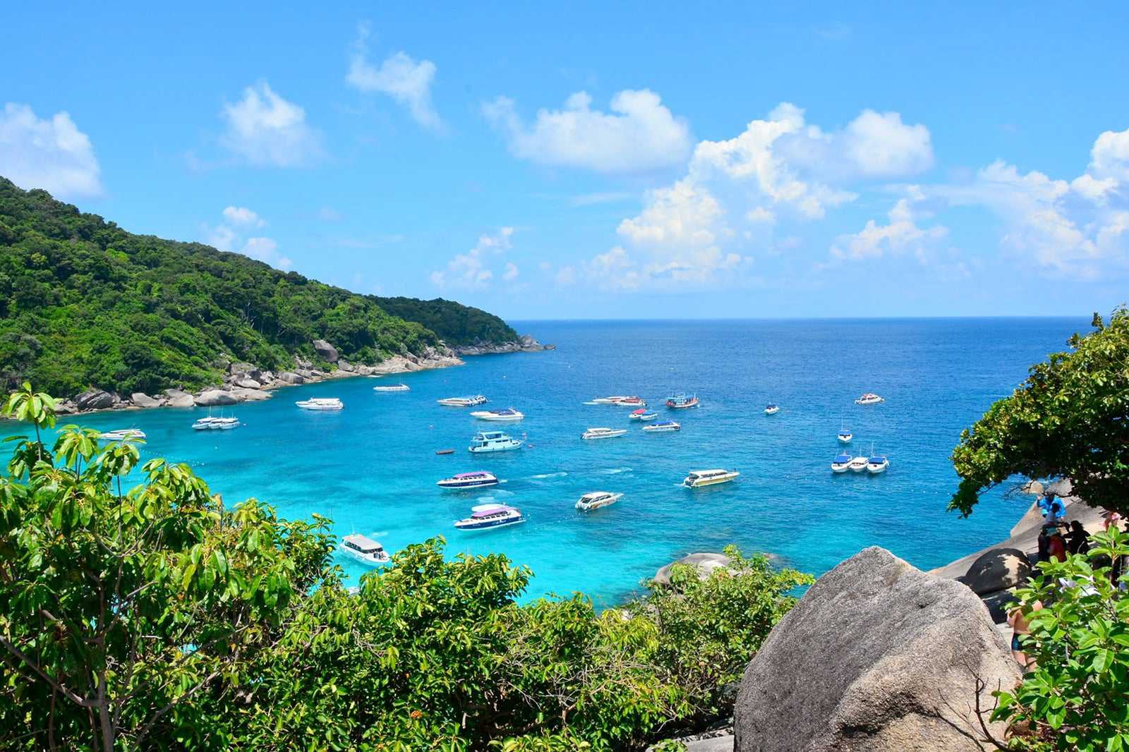
Leer másThe Similan Islands are just 84 km northwest of the bustling crowds of Phuket. Koh Similan is one of the best-known groups of islands in the Andaman Sea, largely because of the wonders that wait beneath the clear blue waters that surround it. Generally counted among the most interesting dive sites in the world, this little archipelago has also become a favourite destination for yachts and tour boats.
The most striking feature of the Similan Islands, at first glance, are the huge boulders that litter the western and southern shores on several of the islands. Another highlight, as you'll soon discover, is the white coral-sand beaches, which are splendidly picturesque and often deserted.
Dirección: Similan Islands, Lam Kaen, Thai Mueang, Phang Nga Province, Thailand
Mapa- 3
Khao Sok National Park

- Aventuras
- Parejas
- Familias
- Fotos
Khao Sok is a national park about 50 km northeast of Khao Lak. Belonging to the Province of Surat Thani, it is a low mountainous area (the highest point is at 950 metres) covered by the oldest evergreen rainforest in the world.
The central area of Khao Sok National Park hosts the manmade Cheow Lan Lake, contained by Ratchaprapha Dam. Like an inland sea, the 165-sq-km lake has the same characteristics as the famous Phang Nga Bay: tall limestone karst formations jutting out from the emerald waters of the lake, with sandstone and mudstone hills covered by vegetation even more diverse than the Amazon.
Dirección: Phanom District, Surat Thani 84250, Thailand
Mapa - 4
Erawan Falls

- Parejas
- Familias
- Fotos
The Erawan Falls is part of a national park of the same name that covers a pristine area of 550 sq km. Located some 40 km northwest of Kanchanaburi town, the 7-tiered waterfall has plunge pools, stunning cascades, rock formations, and the warm, humid and mysterious atmosphere of the rainforest.
Each step at Erawan Waterfalls has its own aspect and characteristic, offering several types of waterfalls in 1 place – ledge, plunge, horsetail, cascade, and more. The hike to Erawan Falls takes roughly 4 hours. You can hire a guide if you wish, but the trail is pretty well-marked and easy to follow. The only challenging part is between the 5th and 7th waterfalls, where you'll encounter unsteady ladders.
Dirección: Tha Kradan, Si Sawat District, Kanchanaburi 71250, Thailand
Mapa - 5
Khao Yai National Park

- Aventuras
- Parejas
- Familias
- Fotos
Khao Yai is a UNESCO World Heritage Site and Thailand’s 3rd-largest national park. It spreads across 4 provinces: Saraburi (west), Nakhon Nayok (east), Nakhon Ratchasima (north) and Prachinburi (east). Blessed with a lush, mountainous landscape, with fertile valleys, pounding waterfalls and rich biodiversity, Khao Yai is a year-round getaway destination just 3 hours’ drive from Bangkok.
It’s a good idea to drop by the park’s headquarters (closes at 6pm) and visitor’s centre to pick up a map and plan your journey. Trips can include hiking along the 5 scenic routes, wildlife watching at Nong Pak Chee or Mo Singto, and visiting the park’s highest summit at Khao Rom.
Dirección: Hin Tung, Mueang Nakhon Nayok District, Nakhon Nayok 26000, Thailand
Mapa - 6
Thi Lo Su Waterfall

- Aventuras
- Parejas
- Fotos
Thi Lo Su Waterfall stands at a height of about 250 metres and with a width of 450 metres. It’s the largest and tallest plunge waterfall in Thailand. Located on the Mae Klong River in Tak Province, close to the border between Thailand and Myanmar, the scenery of Thi Lo Su Waterfall is truly spectacular.
Note that the journey to get there is rather long as the waterfall is in a remote area of Thailand, but this impressive 4-tiered fall is worth the effort, even if only to experience the trek in an unspoiled natural environment. From the park headquarters, you need to walk about 2 km to reach the waterfall. Guided tours are available.
Dirección: Mae Chan, Umphang, Tak Province 63170, Thailand
Mapa - 7
Tham Lot

- Aventuras
- Parejas
- Familias
- Fotos
With a total length of 1,666 metres, Tham Lot is one of the longest cave systems in Thailand. Located about an hour’s drive north of Pai in Mae Hong Son Province, just 15 km from the border between Thailand and Myanmar, the cave can both be visited on foot and onboard a raft. Guided tours provided by villagers are available.
Important archaeological remains dating back thousands of years have been found in Tham Lot, as well as impressive limestone stalactites and stalagmites all along the underground pathway.
Dirección: Pang Mapha District, Mae Hong Son 58150, Thailand
Horario: Daily from 8am to 6pm
Mapa - Parejas
- Familias
- Fotos
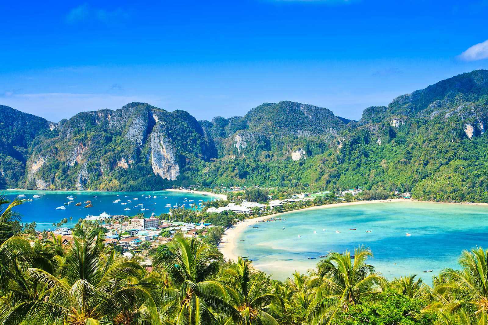
Leer másThe Phi Phi islands are just a 45-minute speedboat trip or a 90-minute ferry ride from either Phuket or Krabi. These picture-postcard islands offer the ultimate tropical getaway in Thailand. Home to classic tropical beaches, stunning rock formations, and vivid turquoise waters teeming with colourful marine life, it’s a paradise for many people.
Phi Phi is a group of 6 islands. The 2 main islands are Phi Phi Don and Phi Phi Leh. The larger and inhabited Phi Phi Don attracts hundreds of visitors to stay on its lovely shores. The smaller uninhabited Phi Phi Leh hosts stunningly beautiful bays and beaches, including the world-famous Maya Bay, which was where The Beach (2000) was filmed.
Dirección: Krabi Province, Thailand
Mapa- 9
Doi Inthanon National Park

- Parejas
- Familias
- Historia
- Fotos
Doi Inthanon National Park consists of rugged mountainous terrain blanketed by lush tropical forests, along with mighty rivers and majestic waterfalls. The park's protected status makes it a sanctuary for a wide range of animals. It's perhaps the best place in Thailand for birdwatching.
The highest peak in Thailand, Doi Inthanon rises to a height of 2,565 meters above sea level. The national park which contains Doi Inthanon and bears its name covers 482 sq km. The diversity of Doi Inthanon does not only extend to plant and animal species – the park has long been home to settlements of northern hill tribes as well.
Dirección: Ban Luang, Chom Thong District, Chiang Mai 50270, Thailand
Mapa - 10
Ang Thong National Marine Park

- Parejas
- Familias
- Fotos
Ang Thong National Marine Park is a pristine archipelago of 42 islands in the Gulf of Thailand, with towering limestone mountains, thick jungle, white-sand beaches, fertile mangroves, waterfalls and hidden coves and lakes to explore.
Within sight of Koh Samui, Ang Thong Marine Park is a protected area of more than 100 sq km of land and sea. It's also home to a rich variety of exotic wildlife and sea creatures. Snorkelling, hiking, sea kayaking, diving, sailing, and simply relaxing on one of its idyllic beaches are the main activities you can enjoy at Ang Thong National Marine Park.
Dirección: Thongsala Koh Phangan, Surat Thani 84280, Thailand
Mapa


